
Overview
Thrust 4 develops data-driven tools and analyses to identify, visualize, and reduce energy–health vulnerabilities across communities, with a focus on low-income and socially disadvantaged populations.
Spatial Patterns of Energy Burden and Vulnerability
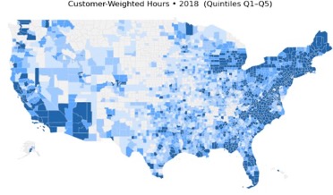
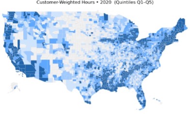
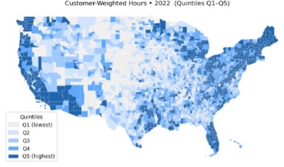
Maps illustrate persistent and evolving geographic inequities in outage exposure, motivating integrated energy–health vulnerability analysis.
Research Focus & Methods
- Interactive ArcGIS-based energy–health vulnerability mapping platform
- Integration of census, environmental, energy, and public health data
- Advanced geospatial modeling and machine learning methods
- Analysis of power outages, climate change beliefs, and extreme weather health effects
- Open-access data infrastructure development
- Public dashboards for visualization and decision support
Key Themes
Current Work
We build an interactive, ArcGIS-based energy–health vulnerability mapping platform by integrating data from census, environmental, energy, and public health sources. The tool combines social vulnerability, environmental exposure, energy burden, and health indicators to support local validation in Tennessee and scalable applications at state and national levels. Advanced geospatial modeling and machine learning methods are used to examine how energy insecurity and environmental risks translate into unequal health outcomes over time.
Policy & Community Relevance
To support transparency and long-term impact, Thrust 4 also establishes an open-access data infrastructure that links environmental justice, health, and energy datasets and provides public dashboards for visualization and decision support. Together, these efforts enable evidence-based planning, targeted interventions, and more equitable energy and public health policies.